
Geography
It is our intent that children are able to question the world they live in through investigation and exploration through fieldwork. Children will learn about the physical world and the human impact we can have on it. They will be able to create reasoned arguments informed by well-balanced opinions using an extensive base of geographical vocabulary.
We want our children to have...
- An excellent knowledge of where places are and what they are like.
- An excellent understanding of the ways in which places are interdependent and interconnected and how much human and physical environments are interrelated.
- An extensive base of geographical knowledge and vocabulary.
- Fluency in complex, geographical enquiry and the ability to apply questioning skills and use effective analytical and presentational techniques.
- The ability to reach clear conclusions and develop a reasoned argument to explain findings.
- Significant levels of originality, imagination or creativity as shown in interpretations and representations of the subject matter.
- Highly developed and frequently utilised skills in fieldwork and other geographical techniques.
- A passion for and commitment to the subject, and a real sense of curiosity to find out about the world and the people who live there.
- The ability to express well-balanced opinions, rooted in very good knowledge and understanding about current and contemporary issues in society and the environment

Threshold concepts:
At Our Lady of Lourdes, we aim to develop the following concepts through the progressive teaching of geographical knowledge, skills and understanding. These essential threshold concepts are based on the requirements of the National Curriculum Programme of Study for Key Stage One and Key Stage two.
|
Investigate places and their features |
Investigate environments, patterns and processes | Geographical enquiry |
|---|---|---|
| This concept involves having world knowledge of locations, places and geographical features | This concept involves the conditions, processes and interactions that explain features, distribution patterns and changes over time and space. | This concept involves observing, collecting, analysing, evaluating and communicating geographical information. |
Our Geography and History curriculum is taught through mini topics- these can be found below:
| Year 1 | Year 2 | Year 3 | Year 4 | Year 5 | Year 6 |
|---|---|---|---|---|---|
| Treasure Island | From A to B | Island Life | Temples, Treasures and Tombs | The Story of English | WWII |
| The Magic Toymaker | Windrush and the impact of migration | ||||
| A Day in the Life | Buildings | Bienvenue en France | Victorians | Earth as an Island | Greeks and Romans |
| China | Gateways to the World | ||||
| Seaside | Time Travellers | Scavengers and Settlers | Earthquakes, Mountains and Volcanoes | AD900 (Aztecs) | El Salvador |
Click below for the learning in each year group
EYFS
Each area of the EYFS curriculum has an Early Learning Goal, which is the standard that a child is expected to achieve by the end of their reception year. The ELG (Early Learning Goals) covers all of the 7 areas of learning as specified in the Early Years Foundation Stage Curriculum.
The following link to the teaching and learning of geography in our EYFS:

|
ELG: Understanding of the World: People, Culture and Communities |
|---|
|
| ELG: Understanding of the World: The Natural World |
|---|
|
Year 1
| Treasure Island | Autumn 1 | Autumn 2 |
|---|---|---|
| Overview | What can we learn about the world? We can describe an island using a map What can we learn about the world from a globe? Which countries are in the UK? What are the 7 continents and 5 oceans? |
What are the hot and cold places on earth like? How would a pirate travel to Bali and Lapland? Where are the hot and cold places? What is the climate in an island near the equator like? What are the Polar Regions like? What is the climate like in England? |
| Concepts | Locational Knowledge; UK & Global; Climate; mapping skills |
Locational Knowledge; UK & Global; Climate; mapping skills |
| A Day in the Life | Spring 1 | Spring 2 |
|---|---|---|
| Overview | What’s around our school? Where is our school? What are the key features of our school environment? What can we use the different areas of our school for? How can I use a map to plan a route? What are the possible ways people travel to school |
What is the UK’s weather like? What is weather? What is the weather like today? What is a season? What is the difference between the seasons? What are the different types of clouds? What weather is most likely if we have stratus clouds? How are we affected by extreme weather? What is the most frequent occurring weather in our local area? |
| Concepts | Place Knowledge; Physical and Human Features | Place Knowledge; Physical processes and impact; Climate |
| The Seaside | Summer 1 | Summer 2 |
|---|---|---|
| Overview | What is the UK like? Which countries are in the United Kingdom? What country and city do we live in? What are the capital cities of the countries in the United Kingdom? Where is Scotland? What are some key physical and human features of Scotland? Where is Wales? What are some key physical and human features of Wales? Where is Northern Ireland? What are some key physical and human features of Northern Ireland? What are the differences in physical and human features across England? Use of maps to identify and locate the countries in the UK. |
Where do we live? What are the key human features of our local area? What are the key physical features of our local area? Do we have more natural or man-made sounds in our local area? Why do people come to our local area? What types of houses are in our local area? What could we use maps for? How much green space is in our local area? Use walks around the local area to complete observations. |
| Concepts | Human and Physical Interactions; Location and Mapping Skills | Locational knowledge; Place Knowledge; Human & Physical Features; The United Kingdom; Map skills |
Year 2
| From A to B | Autumn |
|---|---|
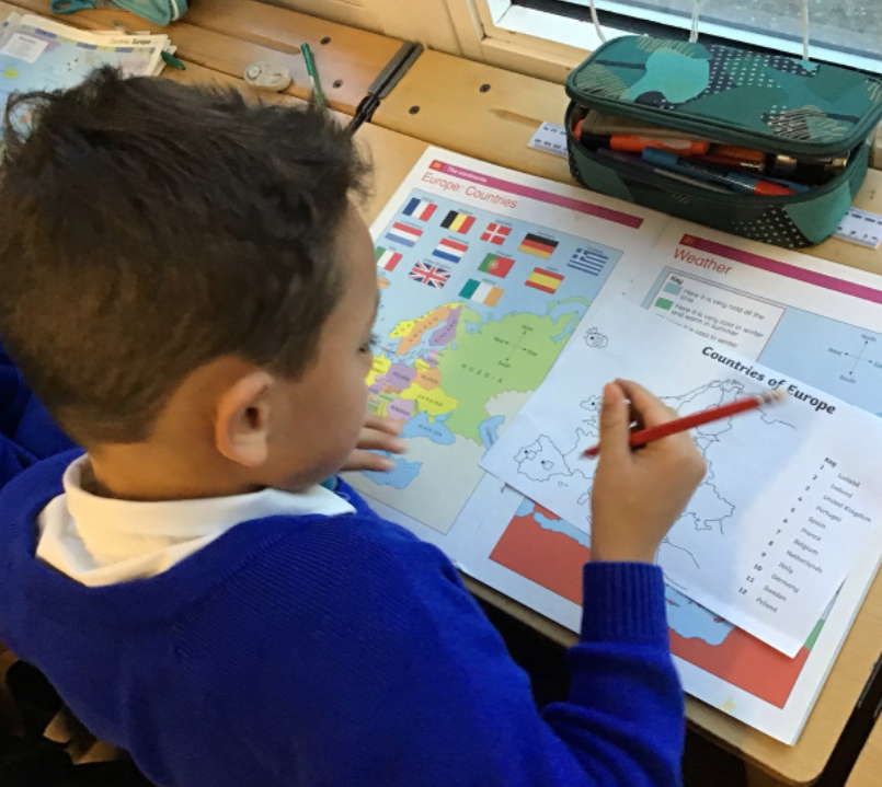
| Overview | Where are places in the world? What are the 7 continents and 5 oceans? Can you use an atlas to locate the 7 continents and 5 oceans of the world? Where is the UK? Can you use an atlas to find the four countries of the UK and their capital cities? What are the unique features of each continent? What are the key features of Africa? What are the key features of South America? What are the key features of North America? What are the key features of Antarctica? Why do continents have different climates? What are the similarities and differences between each continent? |
| Concepts | Human and Physical Interactions; Climate ; Location and mapping skills |
|
Buildings/ China |
Spring 1 | Spring 2 |
|---|---|---|
| Overview | What are buildings like in our town of Leigh? What landmarks and buildings can you recognise in the local area? Create a map of the local area with a key. What are the human and physical features of the school grounds? What buildings do they see? Draw map of school grounds-aerial view Investigate the different kind of houses in the local area. What does this tell us about how our town has changed over time? What are the human and physical features of towns? What is the difference between a village, town and city? |
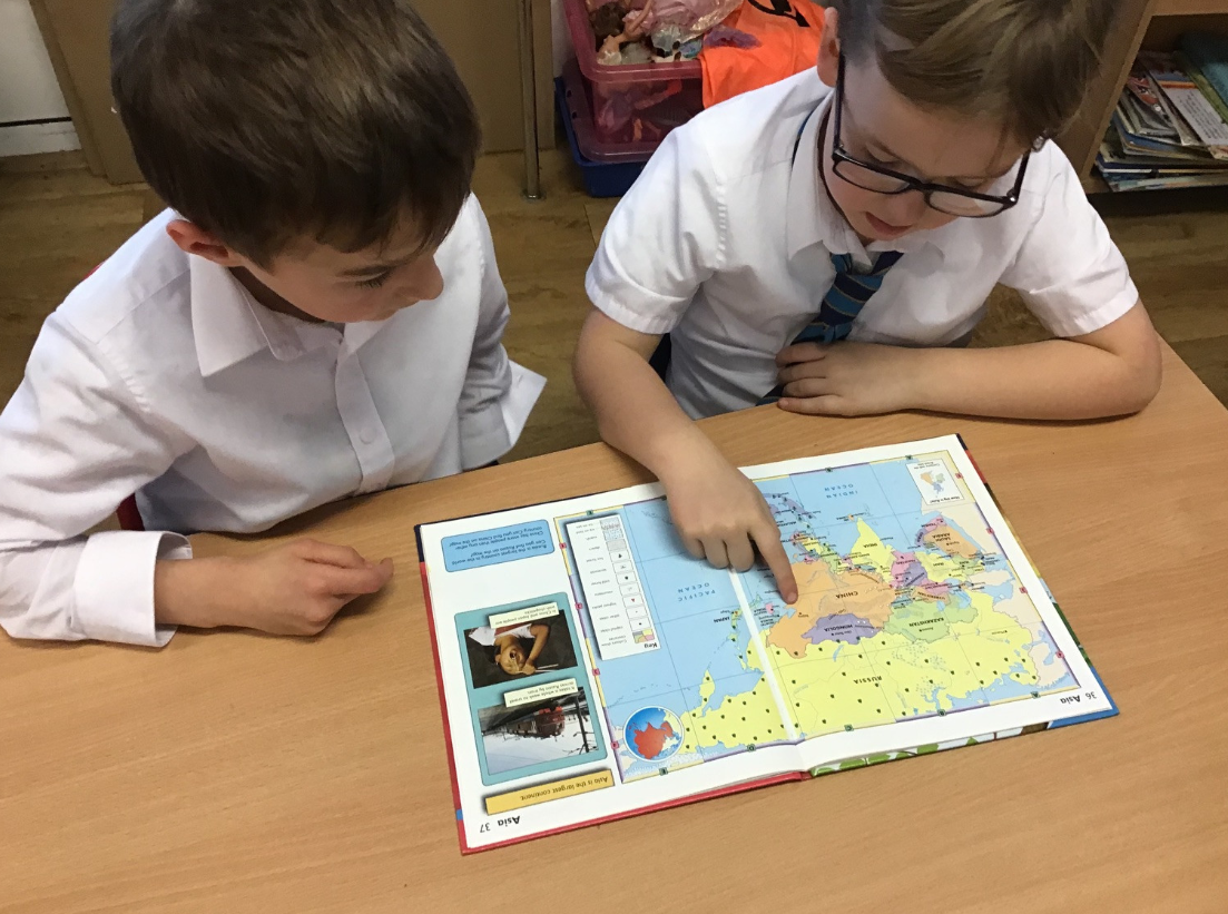
What is China Like? Where is China? Can you use an atlas to find China and identify its major cities, rivers and landmarks? What is China like? Compare the map of the UK, the countries and capital cities with the map of China and Beijing. Compare the buildings in China with the buildings from our town What is it like to live in China? |
| Concepts | Locational Knowledge UK; Human Features | Place Knowledge: Global; Physical and Human Features; Climate |
Year 3
| Islands | Autumn 1 | Autumn 2 |
|---|---|---|
| Overview | How can we use a map to tell us about islands? Can we locate islands on a map? Can we locate the seven continents and five oceans in the world? Where are the islands we have located? Are they close to a continent? Are they in the N or S hemisphere? What is the purpose of the key in a map? Why do maps have scales? Can we use maps to describe what our islands are like? What are their human and physical characteristics? Can we investigate the characteristics of an island e.g. Galapagos |
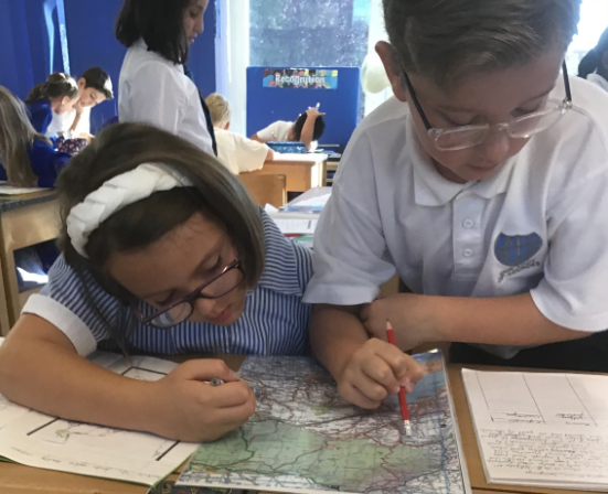
How does water affect our lives? What is the water cycle and how does it work? What is a river? What are the landforms along a river? What human interactions do we have with rivers? What is a coastal zone? What processes occur at the coast? Erosion, deposition and transportation. How are humans protecting the coast? Use of OS maps to identify coastal areas and features. Interpretation of photos to see how areas have changed over time. Interpretation of diagrams to understand key features and landforms found along rivers and coasts. Fieldwork visits to a local stream to measure width, depth, velocity. This data will then be used to construct simple graphs to show how a river changes over time. |
| Concepts | Locational Knowledge | Physical Geography: Features, Impact, Process, Climate |
| Bienvenue en France | Spring |
|---|---|
| Overview | What makes France distinctive? Where is France? What are France’s main physical features? Why and how do people live in Paris? What are human and physical features of Paris? How has Paris changed over time? Use a grid reference and compass points to describe the location of key features in France Use map symbols and a key to identify key features in France |
| Concepts | Locational Knowledge; Place Knowledge; Physical Geography: Features, Impact, Climate; Human Geography: Features, Impact, Processes; Interactions between physical and human geography; |
| Gateways to the World | Summer 1 | Summer 2 |
|---|---|---|
| Overview | What is it like to holiday in the UK? Can you name and locate holiday destinations in the UK? What counties are they in? What cities are they close to? Can you name and locate the physical features in the UK that attract holiday makers? What regions of the country are they in? What is a region? Why and how do people holiday in London? What are the physical and human features of London? How has London changed over time? |
What is Southend Airport like and where can you travel to? Can you name and locate the holiday destinations you can travel to from Southend Airport? Can you compare and contrast the destinations you can travel to from London Heathrow airport? (Can you locate countries in Europe, Russia, North and South America?) Where is Southend Airport? Can you describe the route to Southend Airport from school using compass points? What is land use like at Southend Airport? Use maps, aerial photographs or fieldwork to investigate the land use around Southend Airport. Design an airport map using symbols and considering the services required at an airport. |
| Concepts | Locational Knowledge; Place Knowledge; Physical and Human Features | Locational Knowledge; Place Knowledge; Physical and Human Features |
year 4
| Temples, Treasures and Tombs | Autumn |
|---|---|
| Overview | Why was the River Nile important to Ancient Egyptians? Can we locate Egypt and the River Nile on a map? What are the features of the River? Why was the River important to the Egyptians? Is the River important today? |
| Concepts | Locational Knowledge; Place Knowledge; Physical and Human Features |
| Victorians | Spring |
|---|---|
| Overview | Why do people live in Leigh On Sea and the surrounding area? What are the different types of land use in our area? Where are the settlements in our area? What are these places called? Investigate buildings and landmarks; what does this tell us about how tell us about how the Victorians influenced settlement in our surrounding area? What influence did the railway line have on people’s lives? Why do people live in our town today? Interpretation of OS maps to locate and describe settlements. |
| Concepts | Physical geography: features, weather and climate. Human geography: features, impacts of humans on areas, land use, interactions between human and physical geography. |
| Mountains, Earthquakes and Volcanoes | Summer |
|---|---|
| Overview |
How do earthquakes affect people?
How do volcanoes affect people? |
| Concepts | Human and Physical Interactions; Climate; Geomorphology; Sustainability; Development |
Year 5
| Earth as an Island | Spring 1 | Spring 2 |
|---|---|---|
| Overview | What resources do we use and why? Where does your food come from? What is the impact of food supply on the environment? What is sustainable living? How big is my footprint on the world? |
What is it like living on Scilly? What do we know about islands? What impact do humans have on islands? What are the location of islands and their capital cities? What are the physical features of Scilly? How are these represented on a map? Why is it challenging to live on an island? What are the push and pull factors for islanders when considering moving to the mainland? What must you consider when relocating an island community? Can I use OS symbols to create an imaginary island? Can I use 4 and 6 figure grid references to locate features of Bryher ? |
| Concepts | Human and Physical interactions |
| AD900 | Summer 1 | Summer 2 |
|---|---|---|
| Overview | Why are lines of latitude and longitude so important? What are lines of latitude and longitude? Where are the key lines of latitude? (equator, Tropics of Cancer and Capricorn, Arctic and Antarctic Circles) Where are the key lines of longitude? (Prime Meridian and Greenwich) What are the northern and southern hemispheres? What are the latitude and longitudes of different countries and continents? What are time zones? Why is daytime in some parts of the world but night-time in other places? Use of atlas to identify latitudes and longitudes Use of world map and globe to identify key lines of latitude and longitude |
What are global biomes and why do they differ so much? What are the different biomes and where are they found? Why is climate a key factor for determining the nature and location of biomes? Where are the three forest biomes found and what are they like? Where are desert biomes found and what are they like? Where are tundra biomes found and what are they like? How are biomes similar and how are they different? Which biomes are the most important ecologically? (natural resource distribution) Use of Google Earth to locate biomes Use world map template to complete a simple map of global biomes |
| Locational Knowledge: Global; Physical Features | Human and Physical Interactions Climate Regions and mapping skills |
Year 6
| Windrush and the impact of migration | Autumn 1 |
|---|---|
| Overview |
Why did people leave the Caribbean? Where are the Caribbean countries ? What countries and ocean are close to it? What hemisphere are they in and where is it in relation to the Tropics? |
| Concepts | Locational knowledge: place knowledge. Physical geography: features. Human geography: features, interactions between human and physical geography. |
| El Salvador | Summer |
|---|---|
| Overview | What makes El Salvador distinctive? Where is El Salvador? What countries and ocean are close to it? What hemisphere is it in and where is it in relation to the Tropics? Use maps and atlases to locate San Salvador and other major cities in El Salvador. Identify other key features in the country such as mountain ranges, volcanoes, lakes, and coastal regions. What is the climate of El Salvador like? What difficulty does this cause for the people who live there? Why are there so many volcanoes in El Salvador? Why do people live near volcanoes and what is the impact for the people who live there? What is the land used for in El Salvador? How can farmers be sustainable? Why do people migrate from El Salvador? What are the push and pull factors that make people migrate? |
| Concepts | Locational Knowledge; Global; Place Knowledge; Global; Physical Geography (Features, Impact, Climate); Human Geography (Processes, Impact and processes) |